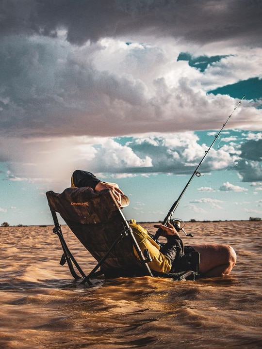
Slow but relentless, a vast swathe of water is moving through the Channel Country.
It transforms the dry, red-dirt desert into a green oasis spotted with wildflowers, creating a “spectacular blanket of all different colours”.
Birdsville resident Liam Brooker says the water brings the community together.
“We go out and we sit in the water. The kids splash around,” he said.
“[We] take a couple of beers down and have a good yarn.”
Birdsville Aviation manager Ben Fullagar said it was an astonishing ecosystem.
“We’re out here in the middle of the desert and it’s so green it’s unbelievable,” he said.
“In between all those fingers of water, there’s wildlife, there’s bird life, there are pigs, there are all sorts of different animals running around out there.
“All of this life that germinates out of the soil, the seeds that may have been sitting in there for many, many years, germinate into this spectacular blanket of all different colours.”
Loading…
The water has accumulated from flooding further north from Ex-Tropical Cyclone Kirrily.
The floodwaters, having covered hundreds of kilometres through the outback, now make their way to the Kati Thanda-Lake Eyre Basin.
“Sadly, the water that causes havoc in the northern end of Australia is such a godsend … for graziers and tourism,” Mr Fullagar said.
He said whenever the Channel Country flooded, tourists flocked to Birdsville to catch a glimpse of the “inland sea”.
“Everyone just starts to turn up. We get in our airplanes, and we follow the journey of this water,” Mr Fullagar said.
“It just makes you realise how powerful Mother Nature is and how lucky we are to have this resource out here in the middle of Australia.”
Where is the water going?
Bureau of Meteorology senior meteorologist Dean Narramore said, as a rule of thumb, heavy rainfall always pooled to the lowest point.
“If it falls over land or mountains, it always flows to the ocean because that’s the lowest point,” he said.
But things were different in the flat expanse of the outback.
“Through the inland parts of the country … the lowest point is Lake Eyre,” Mr Narramore said.
“So it’s actually lower than heading off towards the coast.”
The Kati Thanda-Lake Eyre Basin spans 1.2 million square kilometres, covering parts of South Australia, the Northern Territory, Queensland, and western New South Wales.
At 15 metres below sea level, it is the lowest point in Australia. Depending on where the rain falls, it spreads out in different directions.
Any rainfall north of Cloncurry flows to the Gulf Country and rainfall east of Hughenden and Emerald surges to the Coral Sea, according to Mr Narramore.
He said the waterfront moving through the Channel Country was a result of heavy rainfall near Winton following Ex-Tropical Cyclone Kirrily.
“It can take weeks and sometimes months for the water to travel there,” Mr Narramore said.
Roads damaged as water surges on
While the water is good news for the landscape, it is bad news for roads.
Diamantina Shire Council Mayor Robbie Dare estimated they had $20 million worth of road damage so far.
“A lot of that value isn’t just on the road itself. It’s on the drainage system above the road on the higher side where the water came down,” Cr Dare said.
“There’s a lot of helicopter work moving cattle around, moving people around, trying to get council staff to and from work.”
On Thursday, a truck drove more than 1,000km from Townsville to deliver food supplies to properties near Windorah and Birdsville.
“They had to race into Birdsville, unload all the town stuff and get out because the water was coming very quick,” he said.
It’ll be the last delivery for weeks as residents in Birdsville and surrounding areas buckle down and wait for the waters to pass.
Get our local newsletter, delivered free each Tuesday
Posted , updated
Source : ABC News (AU)


